


WASHINGTON TWP Voting District, Linn County, Iowa
About
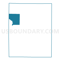
Outline

Summary
| Unique Area Identifier | 582615 |
| Name | WASHINGTON TWP Voting District |
| County | Linn County |
| State | Iowa |
| Area (square miles) | 30.36 |
| Land Area (square miles) | 29.95 |
| Water Area (square miles) | 0.41 |
| % of Land Area | 98.65 |
| % of Water Area | 1.35 |
| Latitude of the Internal Point | 42.17350660 |
| Longtitude of the Internal Point | -91.76758210 |
Maps


Graphs
Select a template below for downloading or customizing gragh for WASHINGTON TWP Voting District, Linn County, Iowa


Neighbors
Neighoring Voting District (by Name) Neighboring Voting District on the Map
- BENTON TWP Voting District, Benton County, IA
- FAYETTE TWP Voting District, Linn County, IA
- GRANT TWP Voting District, Linn County, IA
- MONROE TWP PCT 2 W/ROBINS PART, Linn County, IA
- OTTER CREEK TWP Voting District, Linn County, IA
- POLK TWP Voting District, Benton County, IA
- SPRING GROVE TWP Voting District, Linn County, IA
Top 10 Neighboring County Subdivision (by Population) Neighboring County Subdivision on the Map
- Monroe township, Linn County, IA (13,020)
- Washington township, Linn County, IA (3,369)
- Polk township, Benton County, IA (2,302)
- Otter Creek township, Linn County, IA (1,483)
- Grant township, Linn County, IA (1,376)
- Fayette township, Linn County, IA (1,267)
- Benton township, Benton County, IA (928)
- Spring Grove township, Linn County, IA (860)
Top 10 Neighboring Place (by Population) Neighboring Place on the Map
Top 10 Neighboring Unified School District (by Population) Neighboring Unified School District on the Map
- Cedar Rapids Community School District, IA (119,310)
- Vinton-Shellsburg Community School District, IA (10,406)
- Center Point-Urbana Community School District, IA (6,053)
- Alburnett Community School District, IA (3,267)
Top 10 Neighboring State Legislative District Lower Chamber (by Population) Neighboring State Legislative District Lower Chamber on the Map
Top 10 Neighboring State Legislative District Upper Chamber (by Population) Neighboring State Legislative District Upper Chamber on the Map
Top 10 Neighboring 111th Congressional District (by Population) Neighboring 111th Congressional District on the Map
Top 10 Neighboring Census Tract (by Population) Neighboring Census Tract on the Map
- Census Tract 106, Linn County, IA (5,827)
- Census Tract 102, Linn County, IA (4,745)
- Census Tract 103, Linn County, IA (3,731)
- Census Tract 9604, Benton County, IA (3,270)
- Census Tract 9601, Benton County, IA (3,012)
- Census Tract 101, Linn County, IA (2,970)